1953 North Atlantic hurricane season
Hurricane Carol 1953
Hurricane Carol became the Atlantic's first named Category 5 hurricane in 1953. After crossing the ocean from near Africa, it passed Bermuda and New England before reaching Atlantic Canada. Dangerous seas caused fatal boating accidents, while wind damaged Nova Scotia's orchards and disrupted communications.

Drag to pan. Pinch or Ctrl/⌘ + scroll to zoom. Keyboard: plus or minus to zoom, arrow keys to pan, and 0 to show the full track.
161 mph
Sep 3, 1953 during the tropical stage
Full archive record, including non-tropical stages if present
Along the recorded center positions
STORM HISTORY
From Africa to a Category 5 peak
Carol developed near Cape Verde on 28 August and crossed the Atlantic westward before turning northwest. On 2 September, the steamship Umatilla reported hurricane-force winds and falling pressure, prompting the Weather Bureau to begin advisories. Reconnaissance crews entered the storm the following day.
The current archive records peak one-minute sustained winds of 140 kt at 12:00 UTC on 3 September and a minimum pressure of 929 hPa later that day. Carol then weakened as it approached Bermuda. Aircraft left the island and ships sought harbor before the hurricane passed to the southwest with rough seas and gale-force winds.
Fatal seas off New England
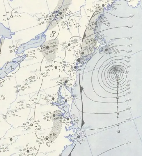
Forecasters issued storm warnings from New Jersey to Maine. Carol passed offshore, but high waves and fog created dangerous conditions for boats. Four people died in New England boating accidents, and Coast Guard crews rescued at least 40 people. Fishing losses totaled about US$1 million in 1953 dollars.
Landfall and damage in Atlantic Canada
Carol brushed western Nova Scotia and made landfall near Saint John, New Brunswick, on 7 September. In Nova Scotia, high seas drove boats ashore and sank eleven yachts at Chester. One man drowned at Cow Bay. Ferry operators suspended or delayed services across the region.
Wind gusts reached 80 mph in Halifax. Fallen trees interrupted power, telephone and telegraph service, while farms in the Annapolis Valley lost large portions of their apple and grain crops. Carol continued through eastern Canada after its tropical phase ended, and the archived track finishes on 9 September.
Further reading
QUICK ANSWERS
Carol in brief
What was Hurricane Carol's highest wind speed?
161 mph, the highest one-minute sustained wind in its tropical stage, recorded on Sep 3, 1953, 12:00 PM UTC.
What category was Hurricane Carol?
Category 5 at its peak on the Saffir–Simpson one-minute wind scale, first reaching Category 5 on Sep 3, 1953, 09:00 AM UTC. Other agencies classify storms differently.
What was Hurricane Carol's lowest pressure?
929 mb, the minimum central pressure recorded during its tropical stage, on Sep 3, 1953, 06:00 PM UTC.
When did Hurricane Carol occur?
The archived track runs from Aug 28, 1953, 06:00 AM UTC to Sep 9, 1953, 12:00 PM UTC, with the tropical stage from Aug 28, 1953, 06:00 AM UTC to Sep 8, 1953, 03:00 AM UTC.
Where did Hurricane Carol form?
In the North Atlantic basin, in the 1953 season. Its first archived position is 14°N, 20.5°W on Aug 28, 1953, 06:00 AM UTC.
Did Hurricane Carol make landfall?
The archive places its center over land at 1 recorded position; the strongest is 81 mph on Sep 7, 1953, 10:00 PM UTC. Positions are six-hourly, so this is not a landfall chronology.
METHODOLOGY
Data sources and limitations
The map and summary are generated from NOAA's IBTrACS v04r01 archive. Wind and category use US-agency records; minimum pressure is calculated during the tropical stage, with the archive's pressure source retained. Category 5 refers to the Saffir–Simpson one-minute wind scale; local agencies may use different classifications. Coastlines use Natural Earth's 1:10m land data.
Track distance adds great-circle distances between consecutive observations, excluding gaps over 12 hours. This track has no gaps over 12 hours. The line shows the storm's center, not its size, rainfall or flood extent. Converted wind speeds are rounded to the nearest whole unit.
Archive retrieved
NOAA IBTrACS archive and Field documentation
Sources & methodology