1997 Eastern Pacific hurricane season
Hurricane Guillermo 1997
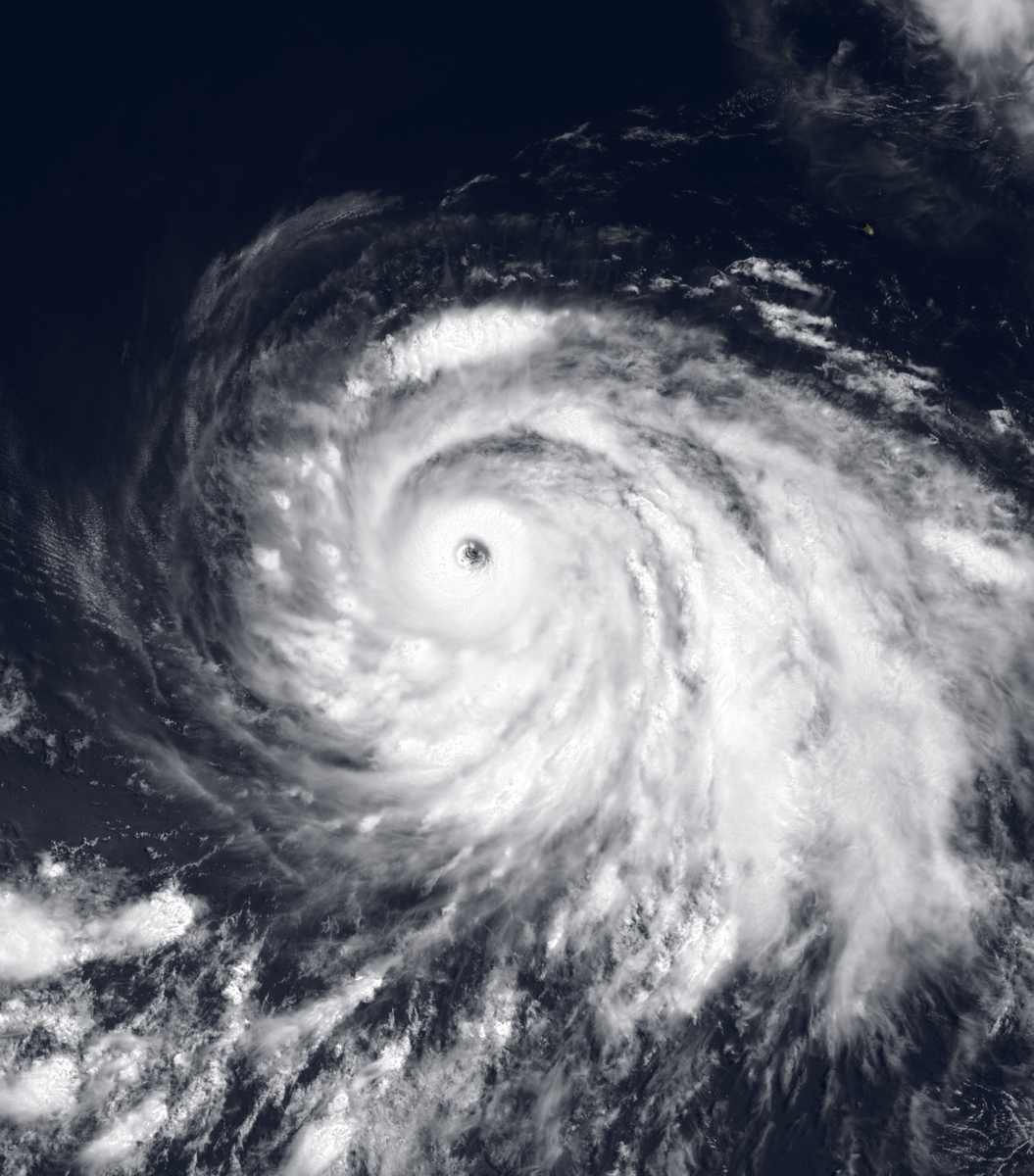
Hurricane Guillermo spent its long 1997 life over the Pacific, but its swells reached distant coastlines. Research aircraft sampled its intensification, gathering detailed wind measurements inside a major hurricane's eyewall.

Drag to pan. Pinch or Ctrl/⌘ + scroll to zoom. Keyboard: plus or minus to zoom, arrow keys to pan, and 0 to show the full track.
161 mph
Aug 5, 1997 during the tropical stage
Full archive record, including non-tropical stages if present
Along the recorded center positions
STORM HISTORY
Aircraft inside a strengthening hurricane
Guillermo developed south of Salina Cruz, Mexico, on July 30 and followed a west-northwest track. It became a hurricane on August 1 and intensified over warm water. The archive records peak one-minute winds of 140 kt on August 4 and a minimum central pressure of 919 hPa early the next day.
Hurricane hunters released dropsondes during the strengthening phase. The mission provided high-resolution wind measurements from aircraft altitude to within meters of the sea surface inside the eyewall, a first for a major hurricane. Radar observations also followed changes in the small eye as Guillermo intensified.
A long track and distant surf
Guillermo weakened over cooler water, crossed into the central Pacific and turned north. It reached about 42°N before becoming extratropical in mid-August. Its remnants persisted for another week, changing direction over the ocean before a larger system absorbed them off California on August 24.
The hurricane made no landfall, but large swells spread toward Hawaii, Mexico and California. Three people drowned in high surf along the eastern Pacific coast: two in Baja California and one in California.
Further reading
NOAA IBTrACS v04r01 historical track archive
Wikipedia, Hurricane Guillermo (1997)
Official report (PDF) — National Hurricane Center, Tropical Cyclone Report.
QUICK ANSWERS
Guillermo in brief
What was Hurricane Guillermo's highest wind speed?
161 mph, the highest one-minute sustained wind in its tropical stage, recorded on Aug 4, 1997, 06:00 PM UTC.
What category was Hurricane Guillermo?
Category 5 at its peak on the Saffir–Simpson one-minute wind scale, first reaching Category 5 on Aug 4, 1997, 03:00 PM UTC. Other agencies classify storms differently.
What was Hurricane Guillermo's lowest pressure?
919 mb, the minimum central pressure recorded during its tropical stage, on Aug 5, 1997, 12:00 AM UTC.
When did Hurricane Guillermo occur?
The archived track runs from Jul 30, 1997, 12:00 PM UTC to Aug 24, 1997, 12:00 AM UTC, with the tropical stage from Jul 30, 1997, 12:00 PM UTC to Aug 15, 1997, 09:00 PM UTC.
Where did Hurricane Guillermo form?
In the Eastern Pacific basin, in the 1997 season. Its first archived position is 11°N, 94.7°W on Jul 30, 1997, 12:00 PM UTC.
Did Hurricane Guillermo make landfall?
No archived position places Hurricane Guillermo's center over land, but positions are six-hourly and a brief landfall can fall between them.
METHODOLOGY
Data sources and limitations
The map and summary are generated from NOAA's IBTrACS v04r01 archive. Wind and category use US-agency records; minimum pressure is calculated during the tropical stage, with the archive's pressure source retained. Category 5 refers to the Saffir–Simpson one-minute wind scale; local agencies may use different classifications. Coastlines use Natural Earth's 1:10m land data.
Track distance adds great-circle distances between consecutive observations, excluding gaps over 12 hours. This track has no gaps over 12 hours. The line shows the storm's center, not its size, rainfall or flood extent. Converted wind speeds are rounded to the nearest whole unit.
Archive retrieved
NOAA IBTrACS archive and Field documentation
Sources & methodology