2003 South Indian cyclone season
Cyclone Inigo 2003
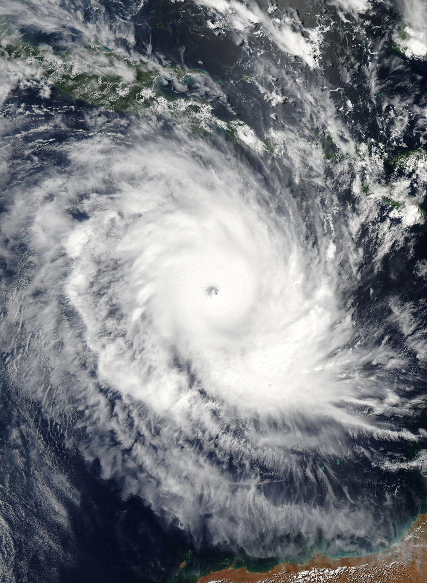
Cyclone Inigo's precursor caused deadly floods and mudslides in eastern Indonesia before the storm reached Category 5 strength offshore in April 2003. By its arrival in Western Australia, it had weakened to a much less intense system.
.jpg)
Drag to pan. Pinch or Ctrl/⌘ + scroll to zoom. Keyboard: plus or minus to zoom, arrow keys to pan, and 0 to show the full track.
161 mph
Apr 4, 2003 during the tropical stage
Full archive record, including non-tropical stages if present
Along the recorded center positions
STORM HISTORY
Deadly rain before the cyclone peak
The precursor low moved west through eastern Indonesia in late March and crossed Flores before entering the Savu Sea. Heavy rain caused flooding and mudslides, with the worst damage on Flores and further destruction on West Timor and Sumba. Thousands of homes suffered damage or destruction, and 58 people died during this early disturbance phase.
Rapid growth north of Australia
After emerging over water and turning southwest, Inigo intensified as wind shear decreased. It developed a distinct eye and reached maximum one-minute winds of 140 kt on April 4, equivalent to Category 5. Its peak occurred far north of Western Australia's coast.
A much weaker arrival in Australia
An approaching trough turned Inigo southeast and weakened its circulation. It reached Western Australia on April 8 at minimal tropical-storm strength, bringing some heavy rain but little damage. The contrast between the deadly Indonesian precursor and the weakened Australian landfall separates the storm's human impact from its offshore wind peak.
Further reading
QUICK ANSWERS
Inigo in brief
What was Cyclone Inigo's highest wind speed?
161 mph, the highest one-minute sustained wind in its tropical stage, recorded on Apr 4, 2003, 12:00 AM UTC.
What category was Cyclone Inigo?
Category 5 at its peak on the Saffir–Simpson one-minute wind scale, first reaching Category 5 on Apr 4, 2003, 12:00 AM UTC. Other agencies classify storms differently.
What was Cyclone Inigo's lowest pressure?
898 mb, the minimum central pressure recorded during its tropical stage, on Apr 4, 2003, 12:00 AM UTC.
When did Cyclone Inigo occur?
The archived track runs from Mar 29, 2003, 06:00 AM UTC to Apr 8, 2003, 06:00 PM UTC, with the tropical stage from Mar 29, 2003, 06:00 AM UTC to Apr 8, 2003, 06:00 PM UTC.
Where did Cyclone Inigo form?
In the South Indian basin, in the 2003 season. Its first archived position is 7°S, 130.6°E on Mar 29, 2003, 06:00 AM UTC.
Did Cyclone Inigo make landfall?
The archive places its center over land at 3 recorded positions; the strongest is 46 mph on Apr 8, 2003, 06:00 AM UTC. Positions are six-hourly, so this is not a landfall chronology.
METHODOLOGY
Data sources and limitations
The map and summary are generated from NOAA's IBTrACS v04r01 archive. Wind and category use US-agency records; minimum pressure is calculated during the tropical stage, with the archive's pressure source retained. Category 5 refers to the Saffir–Simpson one-minute wind scale; local agencies may use different classifications. Coastlines use Natural Earth's 1:10m land data.
Track distance adds great-circle distances between consecutive observations, excluding gaps over 12 hours. This track has no gaps over 12 hours. The line shows the storm's center, not its size, rainfall or flood extent. Converted wind speeds are rounded to the nearest whole unit.
Archive retrieved
NOAA IBTrACS archive and Field documentation
Sources & methodology