1997 Western Pacific typhoon season
Typhoon Joan 1997
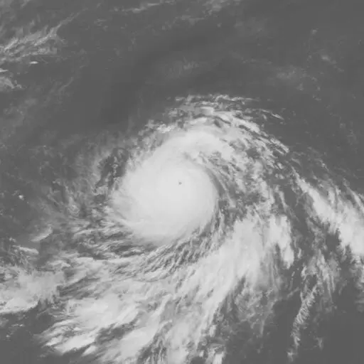
Typhoon Joan maintained super-typhoon strength for four and a half days in October 1997. It passed through the Northern Mariana Islands while Typhoon Ivan, farther west, was also an exceptionally intense storm.
Drag to pan. Pinch or Ctrl/⌘ + scroll to zoom. Keyboard: plus or minus to zoom, arrow keys to pan, and 0 to show the full track.
184 mph
Oct 17, 1997 during the tropical stage
Full archive record, including non-tropical stages if present
Along the recorded center positions
STORM HISTORY
Developing east of Ivan
Joan formed from the eastern part of the same broad tropical trough that produced Ivan. It moved northwest and then west, strengthening much faster than early forecasts anticipated. The archive records peak one-minute winds of 160 kt on October 17 and a minimum central pressure of 905 hPa.
Near peak strength, Joan passed between Anatahan and Saipan. Its prolonged period with one-minute winds of at least 240 km/h set a super-typhoon duration record at the time. Joan later weakened and turned north and east, becoming extratropical on October 24.
Damage across the Northern Marianas
On Saipan, Joan destroyed 37 houses and cut power across the island. Three people suffered injuries while boarding up their home. On Anatahan, crop and property damage totaled about US$200,000 in 1997 currency.
Large waves reached southern Japan and northwestern Hawaii after the island passage. Near Chichi-jima, a boat capsized, killing one person and leaving two others missing. The damage extended beyond the center's route through the Marianas.
IMPACT
Reported impact
| Areas affected | Japan |
|---|
Facts from Wikidata.
Further reading
QUICK ANSWERS
Joan in brief
What was Typhoon Joan's highest wind speed?
184 mph, the highest one-minute sustained wind in its tropical stage, recorded on Oct 17, 1997, 06:00 AM UTC.
What category was Typhoon Joan?
Category 5 at its peak on the Saffir–Simpson one-minute wind scale, first reaching Category 5 on Oct 17, 1997, 12:00 AM UTC. Other agencies classify storms differently.
What was Typhoon Joan's lowest pressure?
905 mb, the minimum central pressure recorded during its tropical stage, on Oct 17, 1997, 12:00 PM UTC.
When did Typhoon Joan occur?
The archived track runs from Oct 11, 1997, 12:00 AM UTC to Oct 25, 1997, 06:00 PM UTC, with the tropical stage from Oct 13, 1997, 06:00 AM UTC to Oct 24, 1997, 03:00 AM UTC.
Where did Typhoon Joan form?
In the Western Pacific basin, in the 1997 season. Its first archived position is 3.8°N, 178.6°E on Oct 11, 1997, 12:00 AM UTC.
Did Typhoon Joan make landfall?
No archived position places Typhoon Joan's center over land, but positions are six-hourly and a brief landfall can fall between them.
METHODOLOGY
Data sources and limitations
The map and summary are generated from NOAA's IBTrACS v04r01 archive. Wind and category use US-agency records; minimum pressure is calculated during the tropical stage, with the archive's pressure source retained. Category 5 refers to the Saffir–Simpson one-minute wind scale; local agencies may use different classifications. Coastlines use Natural Earth's 1:10m land data.
Track distance adds great-circle distances between consecutive observations, excluding gaps over 12 hours. This track has no gaps over 12 hours. The line shows the storm's center, not its size, rainfall or flood extent. Converted wind speeds are rounded to the nearest whole unit.
Archive retrieved
NOAA IBTrACS archive and Field documentation
Sources & methodology