2004 Western Pacific typhoon season
Typhoon Ma-On 2004
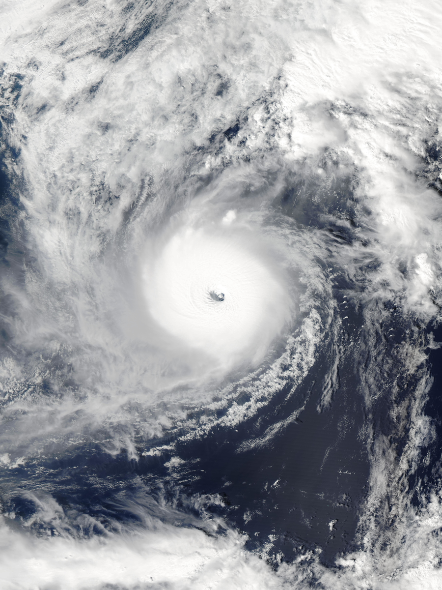
Typhoon Ma-On struck the Izu Peninsula in October 2004 and produced record winds around parts of the Tokyo region. Local terrain intensified winds behind the center as the storm crossed eastern Japan.

Drag to pan. Pinch or Ctrl/⌘ + scroll to zoom. Keyboard: plus or minus to zoom, arrow keys to pan, and 0 to show the full track.
161 mph
Oct 8, 2004 during the tropical stage
Full archive record, including non-tropical stages if present
Along the recorded center positions
STORM HISTORY
Strengthening during a turn toward Japan
Ma-On developed from a weak low northwest of Guam and spent several days organizing. It became a tropical storm on October 4, then a typhoon as it moved north and northwest. An approaching trough turned it northeast and improved its upper-level outflow, supporting rapid strengthening.
Maximum one-minute winds reached 140 kt on October 8. Ma-On weakened as it accelerated toward Japan, making landfall on the Izu Peninsula on October 9. It crossed the country and returned to the Pacific within about six hours, then completed its extratropical transition.
Terrain-enhanced winds and transport disruption
Observers at Irozaki measured a gust of 243 km/h. Around Sagami Bay, some of the strongest winds occurred behind the storm as cool air flowed south along the Kanto Mountains. This terrain-related wind pattern caused damage beyond what the broad storm circulation alone would suggest.
Officials ordered thousands of families to evacuate. Airlines canceled hundreds of flights, and railway operators suspended the Tokaido Shinkansen. The storm also delayed Japanese Grand Prix qualifying at Suzuka. The saved account records seven deaths and two missing people.
Further reading
QUICK ANSWERS
Ma-On in brief
What was Typhoon Ma-On's highest wind speed?
161 mph, the highest one-minute sustained wind in its tropical stage, recorded on Oct 8, 2004, 12:00 AM UTC.
What category was Typhoon Ma-On?
Category 5 at its peak on the Saffir–Simpson one-minute wind scale, first reaching Category 5 on Oct 8, 2004, 12:00 AM UTC. Other agencies classify storms differently.
What was Typhoon Ma-On's lowest pressure?
898 mb, the minimum central pressure recorded during its tropical stage, on Oct 8, 2004, 12:00 AM UTC.
When did Typhoon Ma-On occur?
The archived track runs from Oct 1, 2004, 06:00 AM UTC to Oct 10, 2004, 12:00 AM UTC, with the tropical stage from Oct 4, 2004, 12:00 AM UTC to Oct 9, 2004, 09:00 PM UTC.
Where did Typhoon Ma-On form?
In the Western Pacific basin, in the 2004 season. Its first archived position is 14.3°N, 138.6°E on Oct 1, 2004, 06:00 AM UTC.
Did Typhoon Ma-On make landfall?
The archive places its center over land at 1 recorded position; the strongest is 109 mph on Oct 9, 2004, 09:00 AM UTC. Positions are six-hourly, so this is not a landfall chronology.
METHODOLOGY
Data sources and limitations
The map and summary are generated from NOAA's IBTrACS v04r01 archive. Wind and category use US-agency records; minimum pressure is calculated during the tropical stage, with the archive's pressure source retained. Category 5 refers to the Saffir–Simpson one-minute wind scale; local agencies may use different classifications. Coastlines use Natural Earth's 1:10m land data.
Track distance adds great-circle distances between consecutive observations, excluding gaps over 12 hours. This track has no gaps over 12 hours. The line shows the storm's center, not its size, rainfall or flood extent. Converted wind speeds are rounded to the nearest whole unit.
Archive retrieved
NOAA IBTrACS archive and Field documentation
Sources & methodology